Wednesday, July 30, 2008

TODAY'S HIKE JOINS THE TOP TEN
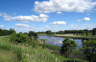
For those of you who have been asking for glamour shots of the Colorado high country, here they are!

Odel had plans to play golf today, so Jackie and Buddy invited me to come along on a hike. I was in the mood for some geocaching (new to them), so we decided on a 5-mile hike just 15 miles up a nearby canyon, to Pomeroy Lake. The hike had a geocache nearby, and is in an area well-known for ghost towns and mining ruins - sounded like a winner, and it was.

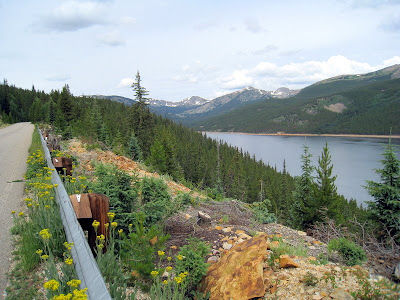
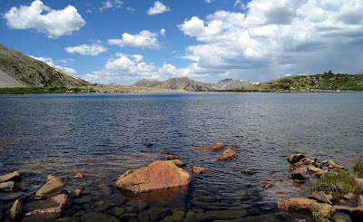
Those peaks you see in the background? Likely 14,000 feet, plus or minus a few hundred - this is an alpine lake, and gorgeous.
The morning was beautiful, sunny and cool, and we got off around 9 am. I had a map and trail description - actually, the trail is a 4x4 road, but of course we were hiking.

We drove the dirt road up, up, up until we located a parking log mentioned in the directions - elevation: 10,564 feet. That was where we started, with a 2,000 foot elevation gain ahead. We started hiking - up.

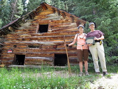
The geocache was a mile into our hike, at "Boss Murphy's House". Jackie and Buddy got right into the spirit of geocaching. The cache managed to elude us for 15 minutes or so, but we won, trading a blue yo-yo from an Arizona cache for a plastic caribiner with a built in flashlight. On our way back down, I was glad we had searched for the geocache on the way up - I was way too tired to do it on the way back!
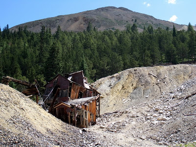
Boss Murphy's house was the first in a series of abandoned mine buildings we passed in the next mile of our climb. This photo shows part of the Mary Murphy mine, a large complex on both side of the road, gradually beaten down by the harsh sun of summer and the heavy snow of winter.

By now we had passed the 11,000' level, and I really felt it. The grade leveled out a bit, and we kept plugging away, stepping off the road now and then for ATV's and Jeeps (we saw 10 or 12 in our 5 hour long hike).

Then the road took a twist and headed uphill steeply for the last half-mile. We had climbed so far that we didn't think of turning back, but at 12,000' elevation I was really sucking in that thin air!
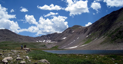
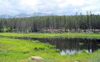
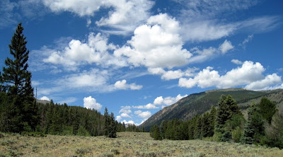
Look closely at this photo and you can see Jackie and Buddy, tiny figures in an awesome landscape. We climbed right up to this glaciated basin holding Pomeroy Lake and stopped at a big flat rock to enjoy our lunch. I took this photo facing one direction (east, I think), then walked to the edge of the lake, facing the other way, to take the top photo.

A gusty breeze kept away the few mosquitos that might have been a bother, and it was cool enough that I put my long-sleeved fleece back on during lunch.

It was high, quiet, and incredibly beautiful, and I was in wonderful company. It is definitely on my Top Ten Favorite Hikes - a challenging hike, beautiful day, perfect weather, and great company. I have a feeling I will sleep very soundly tonight!
Sunday, July 27, 2008

END OF THE BOOMERANG IN BUENA VISTA, COLORADO

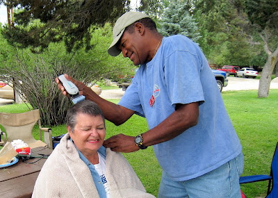
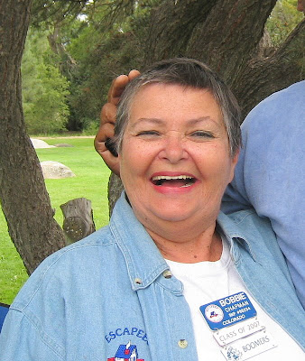
Who is this brave woman, and why is she letting Odel cut her hair in the middle of a city park?

Because the Boomers boondocking site continued to be plagued with mosquitos, we gathered for our traditional 4 pm Happy Hour at the Buena Vista City Park each day. On this particular day, Bobby Chapman asked me where I get my hair cut. Odel started laughing and told Bobby that he cuts my hair, using electric clippers (yes, it is true).

I could see the wheels turning in Bobby's head as we all discussed the difficulty of finding a good haircut as full-timers. Questions followed questions until she got to the BIG question for Odel: will you cut my hair?

Once Odel was convinced that Bobby really wanted such a short cut (her hair was already short, but not SHORT-SHORT), he went off to gather up his "styling tools". Jim, Bobby's husband, got their generator out of the truck and soon a makshift salon was open for business.

The haircut was a big success - Bobby has just the right face and smile for it. This is now Odel's second haircut in the Boomer family; a couple years ago, Jan Kessler convinced Odel to give her the "clipper cut", too. Maybe a workamping job is in his future?

Boomerville broke up Saturday morning, with Boomers fleeing the mosquitos in all directions. There is so much to do in this high Rocky Mountain valley, many of the Boomers (including us) are planning to stay in the area for awhile.

We already had plans to move from Snowy Peaks RV Park (see photos and read our review here), our home for the past week, to Chalk Creek RV Park, just 8 miles down the road, to meet up with our friends Jackie and Buddy Bartee (previously seen on this blog eating Dim Sum in Portland, Oregon, and hosting us at their home base in east Texas) - but that was the extent of our future plans.

There are many RV parks in the area, along with Forest Service campgrounds - but it is very difficult to find open sites this time of year. With the wonderful summer weather and unlimited outdoor activities to pursue, staying around here for a least a couple of weeks sounded like a great plan to me, so we set off on Friday to see what we could find.

Right next door to Snowy Peaks RV Park, we found a commercial RV park that used to be a mobile home community - so the sites are residential sized, not the typical narrow, evesdrop-on-your-neighbors size. We were lucky to snag a huge spot with shade for two weeks starting August 4th. After our fast-moving loops through the Dakotas earlier this summer, I am looking forward to two weeks of going nowhere!

With that accomplished, we planned a daytrip into the high, high mountains yesterday. For the first time since we arrived here, we awoke to clouds rather than sun. Oh, well - the clouds here rarely produce rain, and off we went.

Our explorations began at Turquoise Lake, near Leadville, Colorado. The road around the lake climbs to 10,600 feet (breathtaking, you might say), and several USFS campgrounds snuggled along the shore - all full of families and fisherfolk camped in tents and small travel trailers. This is a popular summer spot!

We didn't see any trails that appealed to us, so headed to the historic Leadville Fish Hatchery, just down the road. Until we visited the fish hatchery in Spearfish, South Dakota, I hadn't known what an important part these historic fish farms have played in introducing trout to the fish-barren high mountain lakes and streams.

The Leadville Fish Hatchery celebrated its 100th birthday in 1989, and fish from this hatchery were first used to stock the lakes and streams in the Black Hills of South Dakota. They have a beautiful old stone building, with fish "races" and ponds out front (and a fantastic view), but we were interested in the trails that penetrate the forest behind the hatchery.

A short walk took us to Evergreen Lake and an interpretive sign at the site of a grand hotel during the 1880's (it burned to the ground in the 1890's). According to the sign, the lakeside hotel had been a favorite spot for the wealthy of Leadville - including the "Unsinkable Molly Brown", who had her wedding breakfast there.

We roamed on up the trail into the Mt. Massive Wilderness area, following a wildflower-bedecked creek, then back down around the holding ponds behind the hatchery. It was a fun day trip, completely whetting my appetite for more... I'm glad we decided to stick around awhile.

Thursday, July 24, 2008

BUSY DAYS IN BUENA VISTA, COLORADO

We did it! As planned, a big group of Boomers (I believe our "pod" - like a group of whales - consisted of 7 rafts with 7 people in each), took to the white water yesterday afternoon for an adventure on the Arkansas River. Boy, did we get WET!

The day started sunny and warm but, as seems to be usual around here, clouded up by the time our river adventure began in the afternoon. No matter - it could have poured the whole time and we would not have been any wetter. Fortunately, you can rent a wet suit and river booties for only $4, which I did and for which I was grateful. Once I managed to squeeze myself into the full body suit, I couldn't wait to get to the water to cool off!

Of the 7 rafts, 2 were "oar boats" - an experienced raft guide sat in the center and piloted the craft with two long, sweeping oars. The other 5 were "paddle boats" - the guide sat in the back yelling instructions to the passengers, each of whom held a paddle. They piloted the raft.

Odel and I chose an oar boat (also called a "wimp boat" by some of the other Boomers). Here I am, leisurely waving to Barry McAllister, a Boomer in the raft behind ours, who provided these photos. I think I was still dry at this point, but the ride (as seen in the top photos) took care of that quickly!

It was a fun trip, 11 miles, just a couple of hours. Lots of laughing, screaming, and occasional quiet contemplation of the lovely canyon. We went home wet and tired, just like kids.

This morning, both Odel and I were up EARLY (6 am). He had a golf date at 8:22 am; I had a hiking date at 8:00 am. 6:00 am came way too early and, in the cool morning temperatures, staying in bed seemed like a really good idea.

It was a beautiful day to be outdoors, though, and soon I was on my way to the campground where the Boomers more hearty than we are have been fighting the mosquitos for the past several days. Nancy Geno (another Boomer wimping out at a full-hookup RV park) and I arrvied, joined the group, and we took off uphill, hoping to leave the mosquitos behind.

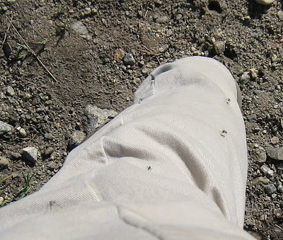
Ha, ha, ha, ha, ha! No way! I hiked in long pants, calf-high socks and boots, a long sleeved cotton shirt covered with a short sleeved nylon shirt, a repellant-soaked bandanna tied around my neck, and a hat. Nancy sprayed me down with repellant and the little buggers STILL landed on me. Look closely, you can count at least 5 mosquitos on my leg as I paused long enough to take a picture.
I even ATE a mosquito that was inhaled when it got too close... UGH!

We pressed on, though, anxious to prepare our bodies for the pizza party planned at the city park (no mosquitos) later in the day, and eventually crossed the 10,000' elevation level - first time I have done that in awhile.

I got home a bit after noon, stripped off my sweaty, Deep Forest Off soaked clothes, and jumped into the shower for a long hot one. When Odel got home, we tossed our clothes into the washer. There is a lot to be said for full hookups!

Tuesday, July 22, 2008

WE FINALLY HIT THE HIGH COUNTRY IN COLORADO

Buena Vista, Colorado, with the 14,000+ peaks in the background.


It's 8 pm MDT as I write this, and the sky is full of dark gray clouds. The wind is still, the temperature is balmy and comfortable in the low 70's. All is calm but Odel, muttering under his breath as he bundles together the packages he is preparing to send to the newest Boomers. This is part of our new volunteer job - we're still getting our procedures worked out!

After two HOT, HOT days in the Denver metro area - we stayed at the Jefferson County Fairgrounds (read our review and see photos here) - we are happy to be in Buena Vista, Colorado, elevation 8100 feet.

We arrived yesterday at 9:15 AM! That was a first for us -we usually don't even begin a moving day until 10 am - but the hot temperatures chased us out early. It's a long, steady, relentless climb out of the Denver area into the Rockies - combined with the high ambient air temperatures, it is easy to overheat on a mid-summer day. An early departure was the smart move.

The Boomers are having a summertime rally near Buena Vista, at a reservoir in a beautiful valley north of town. We had a reservation for one night in a campground in Buena Vista, taking advantage of full hookups to prep for 5 days of boondocking: dump the full tanks, fill the empty water tank, do laundry, pre-cook and prep a few meals, and take long, hot showers for the last time for several days.

As soon as we checked in to the RV park and set up, we jumped into Jules and drove 15 miles north to the rally site to scope things out. This was the scene (through the windwhield) as we approached the camp - doesn't it look idyllic?

Our first clue that something was amiss: fisherfolk on the side of the reservoir were bundled up in sweat clothes, hoods tightened around their faces, even though the temperature balmy. Oh, oh - hadn't we, ourselves, done something similar recently??

When we arrived at the rally site, no one was out and about. We turned a corner and saw a medium-sized, screened tent - packed with about 10 people. After they welcomed us in, we looked like sardines in a can, with mosquitos hanging on the sides of the tent, buzzing!


I guess it is our year for mosquitos. They are so thick near the reservoir that the usual potlucks, happy hours, and various social gatherings have been moved - to a park in Buena Vista.

Since we are completely mosquito-averse, and were already set up 15 miles closer to where the activities were to be held, we came back to the RV park, begged them to find space for us for the rest of the week, and settled in.

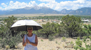
Up at this high altitude, the sun is intense! Even though the temperatures are blessedly moderate, the sun feels like a laser. Before we set out hiking today, I poked around the back of the closet and came up with a special hiking accessory, a mylar umbrella I bought when I hiked the Grand Canyon a couple summers ago. What a blessing it is to have a little personal shade!


We picked a hike along/above the Arkansas River, which runs from the high peaks of the Rockies through Buena Vista and on to the south -at around 50 degrees F. River rafting companies abound, and rafters and kayakers are a common sight everywhere along the river.

We couldn't resist when one of the Boomers organized a half-day river rafting trip. I don't know if I will risk my camera when we go tomorrow - this might be the only photo I will have of rafters for the blog.

Thursday, July 17, 2008

A BROKEN SHEAR PIN - AND HOORAY FOR COACH-NET

Oops. Another day in Deadwood.

As we had planned, we jumped out of bed early, took a walk through town, came home and got ready to move on. The living room slide had different ideas.

The "little trouble" we had extending the slide when we arrived (we had to give it a push) turned into big trouble when it came time to retract. No luck. The motor ran, the slide tried to move, but it stuck after a few inches and no amount of shoving (our first line of attack) would budge it.

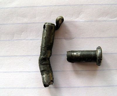
Tool box in hand, we crawled underneath to run our inexperienced eyeballs over the problem. It didn't take us too long to find this sorry sight: a mangled, broken shear pin.

Before long, an inquisitive and helpful neighbor had joined us with his toolbox. Within a couple of hours, the three of us had replaced two broken shear pins, but the slide still was not working. Humpf!

While Odel walked to the office to pay for another night, I called Coach-Net, our highly-recommended roadside assistance provider. David at Coach-Net gathered the information and soon called back to say he had a mobile repair service on the way. Coach-Net pays the service call (in this case, $212); we pay parts and labor for whatever work needs to be done.

A couple hours later, Jim arrived. He had shear pins, he had giant wrenches, he had expertise. An hour later, both of the remaining shear pins had been replaced, the slide was "squared up" to the opening and sliding in and out as it should be. We paid $84 for the repair.

Tomorrow is another day, but the plan is the same: get underway to Colorado! My fingers are crossed.

Wednesday, July 16, 2008

THEODORE ROOSEVELT NATIONAL PARK AND BEYOND

Has it only been 3 days since I last posted to the blog? Wow. We’ve been going non-stop, it seems - or, when we aren’t out sightseeing, what I want to do most is drop on the bed and take a nap. Whew - there is a lot to see in the Dakotas.

When the winds died down in North Dakota, we had one day left before we headed back to the south, and we spent it at Theodore Roosevelt National Park and its “gateway”, the tiny town of Medora. Our first visit here was five years ago, during our first year of travel. We remembered with great anticipation the “Pitchfork Fondue” dinner, one of the very few totally-tourist events that we have recommended. Our first stop: buy tickets for the Pitchfork Fondue.

With tickets in hand, knowing we would have a good meal at 6:30, we went off to hike the badlands of TRNP. We love this park! We drove the scenic loop, stopping several times to take short hikes. We saw bison herds grazing and napping, and a few of the wild horses in the park crossed the road ahead of us. A hot, but beautiful day.

After a late-afternoon stroll around little Medora, we headed up, up, up to the blufftop where the Pitchfork Fondue is “staged”. Long rows of picnic tables are lined up near the edge of the bluff, some under cover, some in the open. They could seat hundreds, and do… besides individuals and groups arriving by car, huge tour buses unload packs of tourists.

Soon, dinner is served and an amazingly long buffet line forms. In return for your ticket, you receive a plastic plate - color coded to show which size steak you purchased - and silverware. A quick trip along the buffet - coleslaw, garlic bread, beans, baked potatoes, cubed melon - and you find youself in front of the “fondue”, where pitchforks loaded with ribeyes and New York strip steaks are plunged into huge vats of boiling oil. Quite a sight!
Well, I am so sorry to say… even as hungry as we were, it was a big disappointment! The upward swing in the price of good beef seems to have resulted in a downward trend in the quality here. We had two tough, overcooked steaks, much of which we left on the plate. No more recommendations on this dinner!

The view, though, is dynamite, so we have a new plan (and recommendation) for our next visit: skip the dinner, but purchase a drink (we had individual-sized bottles of wine) from the outdoor bar. Take it to a bench at the edge of the bluff and drink in the view while you sip. You’ll save $20 each and have a great time.

The next day was a longish, very hot, travel day. We ended it in Deadwood, South Dakota, an ex-mining down on the northern edge of the Black Hills - and the place where Wild Bill Hickok was shot in the back while he played poker. We spent yesterday sightseeing in Deadwood, Lead, and Spearfish, then spent today driving two of the Black Hills more wonderful roads, the Needles Highway and Iron Mountain Road.

There is lots more to tell, but its time to get some dinner going, so I will leave you with one more photo: George Washington's Mt. Rushmore "profile", taken as we left the Rushmore area to head back home.

One of these years, we need to spend more time here in our "home state", but now we are on our way to Colorado to join up with the Boomers again for another Boomerang. The next two days will be devoted to traveling south, then a couple of days to catch up on chores... then off to the high meadows of the Rockies.

Sunday, July 13, 2008

BOOKCROSSING ON THE ENCHANTED HIGHWAY

In a comment on yesterday's post, Judy wondered which book I found in the Grasshopper leg... here it is, Blue Rabbit and Friends.

A quick read! In the end, Blue Rabbit hops on his bike and heads off "to see the world - with the open sky above and the wind in his face", looking for adventure - as were we (especially the wind part).

In its place, I left the Birth of Venus, sorta' figuring that would be the last I would hear about this book for awhile.


Imagine my surprise when I found this message from Bookcrossing in my email when we got home:

__________________________________

Book Title: The Birth of Venus
Author: Sarah Dunant
Saturday, July 12, 2008

I found this book on the Enchanted Highway. It was resting on one of the Grasshoppers legs.

CAUGHT IN ENCHANTED HIGHWAY NORTH DAKOTA USA

By AnonymousFinder
________________________________


That was followed very shortly by another message, sent to me (AreWeThereYet, my Bookcrossing name) as a personal message through Bookcrossing (a way that registered Bookcrossers can communicate with one another while keeping their identities private):

Hello AreWeThereYet,
i found this book.
and it will kill me to ask, were you the woman riding the motorcycle?

Signed, Tank123

_______________________

Oh, poor Tank! I am sure he registered on BookCrossing ONLY to be able to send off his message. No, I most definitely am not the woman riding the motorcycle, his vision of a lovely, leather-clad adventuring female... maybe they exchanged a wave along the road, or shared a few words at one of the scupltures, and what "could have been" looms in his imagination. I'm fairly certain that a past-middle-aged, mostly-gray-haired female who thinks motorcycles look too hot, too cold, too wet, too windy and/or too noisy is not the stuff of his dream.

Isn't Bookcrossing great?

Saturday, July 12, 2008

THE "ENCHANTED HIGHWAY" AND A SPECIAL SURPRISE

Another day of dangerously high winds put an end to our plans to visit Theodore Roosevelt National Park for a hike - or to do ANY walking, for that matter. What to do, what to do?

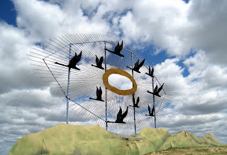
As we drove west on Interstate 94 yesterday, this caught our eyes - Geese in Flight, a gigantic metal sculpture, on the side of the freeway. Looking at the map, I saw a narrow, light gray line, a north/south road captioned "The Enchanted Highway'. Hmmm... very curious.

With walking out of the question today, we decided to backtrack in Jules and explore the Enchanted Highway. We found a brochure in the RV park office, and off we went.

Traffic on I-94, the main east/west interstate through North Dakota, is amazingly sparse, similar to the volume of traffic on a back road in California. I mean, you don't even have to check your mirror to merge at the end of the on ramp! Given that, you can imagine how little traffic you might see on one of the many rural, two-lane roads throughout North Dakota.

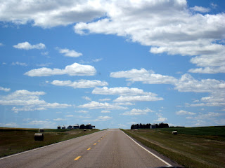
I took this photo through our windshield as we traveled south on the narrow gray ribbon of the Enchanted Highway. No, I didn't pick a time when no other cars were on the road... For 32 miles, from the Interstate exit to the tiny (population 180) town of Regent, this was the extent of the usual traffic.

The Enchanted Highway is the creative dream of Gary Greff, an ex-school principal and now metal artist. Regent is his home town, and he wanted to find a way to save it from extinction. Eighteen years ago, he decided that giant, world-record-sized metal sculptures were the way to bring people from the Interstate to Regent, and that is what he set out to do.

Geese in Flight, on I-94, is the first "hook". A small kiosk in the parking lot describes Gary's vision and the sculptures along the road south - and displays a faded copy of a Smithsonian Magazine article about Gary, his sculptures, and the Highway.

The next installation, two giant deer leaping along the edge of the road (Deer Family), was followed by several miles without another sculpture. The scenery was beautiful, though, a repeat of what we have enjoyed throughout North Dakota - lush green prairie grass, farmer's fields, iconic red barns and wooden farmhouses.

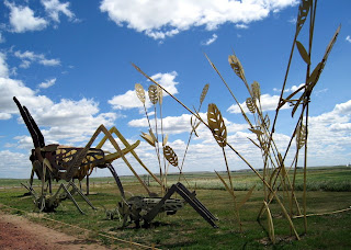
Then: giant grasshoppers in a field of giant wheat.

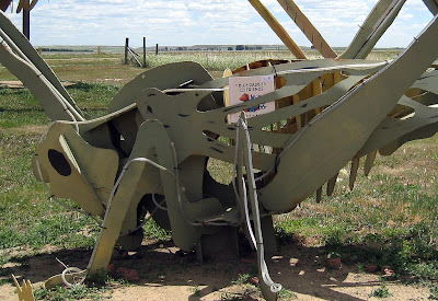
I struggled out of the car to take a photo, with the wind whipping my clothes, and maneuvered for a good shot - and couldn't believe my eyes! There was a book stuck in the leg of one of the baby (my height) grasshoppers, and not just ANY book: a BookCrossing book!

A BookCrosser myself, I have never found a BookCrossing registered book "in the wild". Now, I was staring at one in this remote, "enchanted" spot. Who in the world left it there? A local bookcrosser? Could one exist? I was totally thrilled! What fun! I swapped the "found" book for a book of my own (always keep a registered book in the car, ready to go!) and we were on our way again.

At the outset of our excursion, we decided we would turn around before the end of the Enchanted Highway (32 miles) if we weren't captivated, but Gary Greff's plan to draw tourists all 32 miles to his tiny town worked on us.

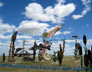
We drove on to see Fisherman's Dream (photo at right), Pheasants on the Prairie, Teddy Rides Again, and The Family. Each sculpture (on land leased from farmers, as we learned later) has a large gravel parking area, a picnic table, and an explanatory kiosk. By the time we reached the last of the sculptures, we were only a mile or two from Regent.

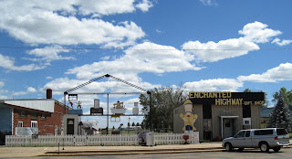
A post office, the city clerk's office, several silos, a gas station, an ag co-op, a couple of B&B's, the American Legion building, a bar with half a dozen motorcycles lined up outside... nothing that would bring tourism to town, or even convince a lost traveler to slow down. That was almost the extent of Regent - except for Gary's Enchanted Highway Gift Shop. When we went in, we found Gary beind the ice cream counter, chatting with another tourist - one of approximately 20,000 per year that follow the Enchanted Highway to Regent.

Of course we had ice cream, and Gary told us his story while we ate it. He's a friendly, mellow guy, completely dedicated to his vision. As the sign welcoming us to Regent said, he has turned the road to Regent into the "Road of Anticipation" - each sculpture draws you a bit farther south, a bit closer to his home town. A man with a dream.

And the book? It had originally been "released into the wild" on July 4th in Roseville, Minnesota. I don't know how it made it's way to the Enchanted Highway, but it made my day.

Friday, July 11, 2008

TEARING AROUND NORTH DAKOTA

We have been moving so quickly recently that I have hardly had time to take pictures, let alone write a post for the blog.

Yesterday was a travel day, planned to be rather leisurely as we drove around 200 miles from Lake Metigoshe State Park south to a Corps of Engineers campground on Lake Sakakawea. Garrison Dam, a COE dam on the Missouri River, created a huge lake with recreational opportunities abounding.

We commented again and again about the beauty of North Dakota - the rolling hills, fields of yellow and blue flowers (blooming crops), the indescribably lush pastures. Once again, the windshield was so smeared with bug bodies that photos were futile.

We arrived at Downstream Campground at Lake Sakakawea in early afternoon and nestled into site 14 (photo). Busy with lunch and planning our future route, we didn't notice the sky clouding until it suddenly became quite dark. We thought we'd get out for a quick walk before the weather deteriorated - oops, too late! Huge raindrops began to splash down as the campground host came around on her bike to warn us about the incoming weather.

Since our weather radio couldn't receive a signal here, we cranked up the TV antenna for a local station and took a look at the weather on the internet. Yipes! A severe thunderstorm warning - which soon changed to a tornado warning - mentioned by name towns a few miles to the south of us. Sheesh. Happily, the brunt of the storm stayed to the south as it moved past at 40 mph.

Greased up with mosquito repellant, we headed back outside to finish our walk and grill chicken for dinner. We planned to hike the trails to the dam and fish hatchery this morning, since today's drive was only 100 miles or so.

As the sun rises very early, so did we. When I did our usual morning check of the weather, we found a High Wind Warning posted for the exact area of our drive today, winds to 40 mph with gusts over 50 - and a special warning for high profile vehicles (Scoopy!). We quickly ditched breakfast and the planned hike. It was so calm when we were breaking camp that mosquitos swarmed -but that changed early in our drive.

By the time we arrived in Dickinson, our planned stop for three days, the wind was fierce - and it was still well before noon. We are so happy to be in place, in a roomy campground on the banks of a little river, stationary. The forecast for high winds was completely accurate and we have remained inside, listening to the big trees groan, since we got here. I feel sorry for anyone on the road today!

Wednesday, July 9, 2008

GEOGRAPHICAL CENTER OF NORTH AMERICA!

Rumble, rumble, rumble, drip, drip, drip... those are the sounds we awoke to on Monday, the day we planned to leave Turtle River State Park. A thunderstorm was moving through, and a check of the weather indicated that staying in place for another day would be a good plan. Well, we can be flexible now and then, so "shelter in place" is what we did.

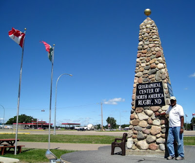
Tuesday dawned (very early) bright, sunny, and cool. We were packed up and ready to go at 9:30 am. Our goal: Lake Metigoshe State Park (read our review and see photos here), right up against the US/Canada border. First, though, we planned a stop halfway, in Rugby, North Dakota - the Geographical Center of North America.

When we rolled into Rugby around noon, we didn't see anything that looked like the Geographical Center, so we stopped in at the little Visitor's Center and got the scoop from the staffer, a longtime resident. He pointed out the monument, right across the street.

When I asked him what it meant to be the "Geographical Center of North America", he told us that, if you were to place all of North America on the head of a pin, Rugby would be the point at which the continent would stay balanced. Okey-dokey!

The little Visitors Center was PACKED with brochures, tour guides, and maps. As I browsed more closely, it appeared they came from every state and from Canadian provinces. When I asked about that, we learned that they take their responsibilities as Visitor Center for the Geographical Center very seriously - they try to stock information from all states in the US and all the Canadian provinces! He said, though, that some of the states aren't generous in sharing their publications, "so we just tell people they are closed". Pretty funny!

After a very filling fried lunch (delicious friend chicken and french fries), we turned north toward the Canadian border. On Monday, the day we had planned to travel to Lake Metigoshe, a tornado had come through the area... no fatalities or injuries, but there had been property damage. We were glad we had stayed at Turtle River an extra day.

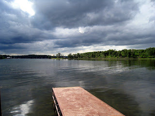
Once we got to the park and were settled in our campsite, we went out for a walk. This is a photo of the lake, taken from a dock in the park. Though it looks terribly dark and stormy, the weather was actually pretty nice, in the low 70's - and NO mosquitos! Maybe Monday's tornado sucked 'em up.

Lake Metigoshe is a laid-back resort area. The state park claims a portion of the shoreline, but small cabins with boat docks ring the rest of the lake. It has a fun, rustic, "summer vacation" feel to it.

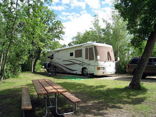
Here is Scoopy in Site 1. North Dakota state parks have a policy we love: half the sites in the campgrounds are reservable, the other half are first-come, first-served. Jan and Barry had alerted us to the fact that the "new" sites at this state park are larger and have 50 amp electricity, so we made sure to let the staffer in the kiosk know that was what we wanted.

Instead, we were directed to the loop with smaller, 30 amp sites. These are the non-reservable sites, and the loop was crammed! The sites that were open were way to small to accommodate a 40' motorhome.

We drove over to the "new" sites, which we had requested - they turned out to be the reservable sites. Of 44 sites, 4 were occupied! The remaining 40 sites were empty - big 50 amp sites, sitting empty. We promptly claimed our favorite, then returned to the kiosk to discuss the situation with the young staffer. To cut the long story short, he finally made a phone call and approved our two night stay in Site 1.

All public parks have different ways of managing their sites, and some work out better than others. It is difficult for us to understand why these beautiful sites are available for use ONLY with a reservation when campers are crammed together in the other loop of smaller spaces...??

Sunday, July 6, 2008

OUR TRIP TO MINNESOTA, FEATURING CABELAS

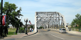
Yesterday we took a trip to Minnesota - East Grand Forks, Minnesota, specifically. Grand Forks, ND, and East Grand Forks, MN, seem like the same town, bisected by the "Red River of the North". In this case, though, the river is the state line.

We walked across the bridge to the Minnesota side for the "Cabela's experience". As they say on their website, it is "like no other retail store on earth!"

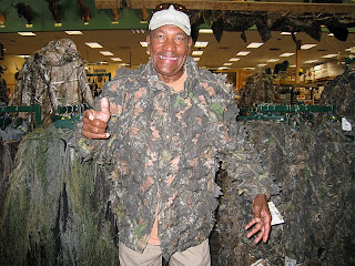
We have to agree. Where else can you find half a dozen different camoflage patterns? Here Odel is modeling oak leaves, attached to a mesh shell. You can barely see him, huh??

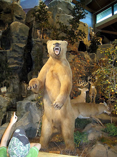
In many stores, we might feel a little self-conscious taking photos, but not in Cabela's. Even for outdoorspeople - hunters and fisherfolk - it is unusual to see a 7 foot tall bear snarling as you walk by (he couldn't see Odel in the camo jacket). Stuffed "trophy" animals of all kinds are displayed in a rock habitat at one end of the store - and not just their heads. A mountain lion snarls from a rock ledge, and two wolves attach a bison. Two bull moose are engaged in battle, while little ground animals watch.

Besides the stuffed mammals, several huge aquariums display the sorts of fish (live) that can be caught around here: yellow perch, bass (large- and small-mouthed), and walleye. Cabela's is quite educational for those of us who have extremely limited contact with hunters. There must be a huge market out there, 'cause this place is gigantic.

With our shopping at Cabela's completed (we bought a safe-and-natural mosquito repellant spray, a dangerous-death-chemical mosquito repellant spray, and a package of mosquito repellant incense sticks), we walked along the banks of the Red River of the North on the Minnesota side. This river flooded in 2000, a situation very similar to the hard-hit cities and towns in Iowa in the past few weeks. Homes and downtown businesses on both sides of the river were lost to the floods.

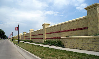
For future protection, both towns built "greenways" between their business districts and the river, resulting in a long, wide park with a walking/biking trail on both sides of the river. Grass covered levees provide extra height, and massive floodwalls, with gates that can be closed at both ends of the bridge, flank the levees. This picture shows the downtown side of the Grand Forks '(North Dakota) flood wall, running parallel to the river.

The resulting floodplain and protective wall have convinced businesses to rehab/rebuild the downtown with restaurants, pubs, bakeries, and independent, interesting downtown shops. A park overlooking the river is the site of a weekly farmers market (our real reason for a trip to Grand Forks yesterday). It looks like a success story.

Tomorrow we are leaving to travel further north, right up to the Canada/US border to visit Lake Metigoshe State Park. Once again, I will be surprised if we have internet access, so I may fall behind on the blog for a few days.

Saturday, July 5, 2008

VOLUNTEER CAMPGROUND HOSTS - NO, NOT US!

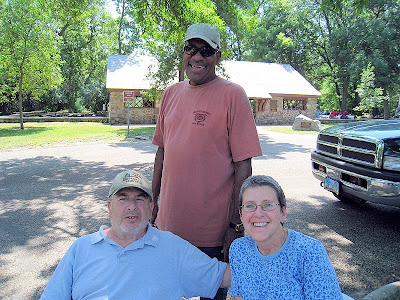
Here with Odel are Barry and Jan Kessler, our fulltiming friends who are volunteer campground hosts here at Turtle River State Park. We've had a good visit with them, and a chance to get the real skinny on the campground hosts' job.

Yesterday, on the 4th of July, Turtle River State Park had a celebration, including a band performance from 1-4 pm, along with free cake and lemonade. Jan and Barry sat in the shade in the parking lot, making certain each car that came in had paid $5 for a day use pass. Odel and I joined them, and before long, eagle-eyed Odel was alerting Jan to any approaching car without a pass. He just loves to work! Jan popped up to collect the fee from anyone who thought they would get in for free. Barry ate cake, passed out dog biscuits and lollipops, and cracked wise. I swatted mosquitos.

The Kesslers are on duty (talking with visitors, cleaning firepits, pulling ticket stubs off campsite posts, recycling cans...) from noon to 4 pm Thursday through Monday, and do a loop through both campgrounds again at night to make sure all campers have receipts. They drop by our place for happy hour after their afternoon shift.

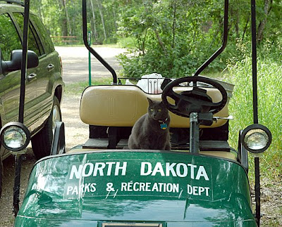
While we sit outdoors and snack, we let Luna roam our little yard. When she is done with her rounds, she usually retires to her crate to lounge and keep an eye on things, but today she decided to try out something new and Barry snapped this photo. She and Odel would make an excellent host team!

Thursday, July 3, 2008

FULLTIMERS ARE NOT CAMPERS!

We have been fulltiming for over 5 years and can tell you one big difference between fulltimers and campers: fulltimers don't do campfires. Or maybe - but rarely. In our case, we have never - not once - built a campfire at our campsite. Until tonight.

In our travels in the "east" (which is what we call any state east of the Rocky Mountains), we have noticed something puzzling: campers will have a campfire anytime of day or night, even when it is 90 degrees! I kid you not.

We have seen campers sitting around a campfire on a hot, humid afternoon while we sit inside with both A/C's going. We once had a neighboring camper step out of his trailer at 2 am, stoke his 24-hour campfire into a blazing bonfire 6 feet from our bedroom (where we had thrown the covers off because we were so HOT), and go back inside! Conclusion: these eastern campers are NUTS.

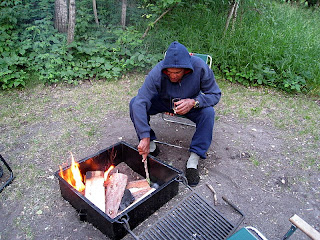
Since we are now in a gorgeous North Dakota campground visiting our friends Jan and Barry Kessler, we decided to do something new: invite them over to our campfire. Sounds fun, huh? And look at Odel, bundled up, tending his fire. What a cozy scene.

Except that it was around 78 degrees. The hoodie, sweat pants, thick socks and slippers? Mosquito defense! Poke the fire, swat a mosquito; toss on another log, smash a mosquito; wipe the sweat off your over-dressed forehead, kill three more mosquitos! No fooling.

Jan and Barry came over, we all sweated and swatted together. It was a first for us - and a last.

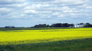
What a beautiful drive we had yesterday through North Dakota to Turtle River State Park (read our review and view photos here). I don't know whether North Dakota is always so lush and green, or if this year is particularly spectacular, but the views of the undulating prairie grasslands and farmer's fields were highly photogenic, even through the filter of dead bugs on the windshield. Sorry I can't tell you what this crop of yellow is, but we saw several fields like this along the way.

Our drive was only 120 miles, all on two lane back roads, and we checked in at Turtle River State Park early in the afternoon. Jan and Barry are volunteer campground hosts here, so we had time to ourselves to explore this huge, beautiful state park on foot for a few hours before we all went into nearby Grand Forks for dinner.

I took this photo at the Wildlife Viewing Area along the state park's main road. Most of the park is either more heavily forested or more manicured than this photo shows, and campers are cautioned to stay on the mowed lawns and trails as poison ivy is EVERYWHERE else (including the edges of our campsite).

Tomorrow is Independence Day, and big crowds are expected for the annual swing band performance here in the park. We're grilling brautwursts and lounging around... perhaps we have a few things in common with campers afterall!

Tuesday, July 1, 2008

STURGIS (SD) TO TURTLE RIVER STATE PARK (ND): DAY TWO


What a day.

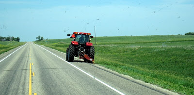
We got a bit of a late start since one of our front tires needed air (hold on while I give silent thanks for our on-board air compressor). Our drive was five hours, longer than our usual, but the weather was so hot (mid-90’s) that zooming along the highway with A/C blasting was a preferred way to spend the day. We crossed the border from South Dakota to North Dakota, rolled past tractors on the highway shoulders and smashed hundreds of bugs on the windshield (which you can see in the photo - no, those aren't birds flying by).

The excitement started when we arrived at our campground. We had selected an RV park and had MADE A RESERVATION so we could count on a FHU site with 50 amp electricity at the end of a hot day‘s drive. Our next five days will be spent in a state park with E only (no sewer), so we wanted to have unlimited water, good electricity and a sewer connection to prepare for our next stop.

We were unimpressed with Prairie Haven Campground (read our review and see photos here). Our feelings were tempered by the warm welcome we received, and we figured the campsite would work for one night.

As soon as we plugged in, we had problems with our inverter - an expensive piece of electrical equipment that is unimportant when we have “shore power”, but of the utmost importance when we don’t. Odel got on the phone to the manufacturer to try to solve what looked like it could be a worrisome problem - but our cell phone signal was so weak, he couldn’t hold the connection.

Next step: set up the phone antenna to strengthen the signal. While he stood outside in the humid 95 degree afternoon heat talking to the techie, I leaned out the bedroom window responding to suggestions Odel relayed to me. Press this button, press that button, flip the switch, try this, try that - okay, what do you see now? Thanks to the sweaty persistence of Odel and the techie, that problem was solved in about 15 hot minutes.

Just as Odel came in to cool off, the air conditioner quit! I knew that meant a shore power problem… yep, all power to the park had blown out (groan). We fired up the generator (oh, thank you, thank you!) and restarted the A/C units to stay cool for the next 3 ½ hours while the local electrical company replaced the transformer.

Although the temperature has dropped to a relatively pleasant 80 degrees now (9:15 pm), the mosquitoes are too numerous to relax outdoors. Odel is sprawled on the bed recovering from the day, and Luna is pooped out on her condo. I have a glass of cold vino at hand and soothing music on Sirius radio, and thus the day winds down.

Happy trails!