Sunday, October 31, 2010

BACK IN SACRAMENTO MAKING BIG PLANS AND PASTA SAUCE

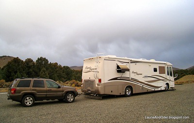
After almost a year, we are back at Cal Expo RV Park (click here to read our review from a past visit) in our ex-hometown, Sacramento, California.  Visiting family and friends tops our agenda, with medical appointments, mechanical repairs, and catching up on deferred projects filling out our time here.

Odel's sauceIt’s been over seven years since we left Sacramento, yet we still know our way around this town better than any other, and we stay put longer here than anywhere else (a month at a time!).  Because of that, there are things we need, or need to do, that we put off until we arrive back here – mostly time-consuming stuff.  Researching big purchases.  Car repairs that we’ve deferred.  Reorganizing and purging our “stuff”.  I renew my cold weather wardrobe here, revisiting favorite small clothing stores (the stores are small, not my clothing – unfortunately).  There is always plenty to keep us busy!

This month, we have another big project to plan: renovations to our motorhome.  Although the engine and chassis of a diesel motorhome may well last as long as we want to travel, the interior furnishing don’t!  Our carpeting is dingy with the effects of 8 years of constant wear, and our window shades are tired and faded.  The loud CLUNK our washing machine makes at the end of each cycle would wake the dead.  Our huge windshield bulges a bit on the upper left corner; in the worst parking situations, we slap a piece of duct tape on the corner in case it rains.  And we’d really like to replace the big, old, heavy, analog TV that hangs over the dashboard with a new, lightweight, flat screen digital model.

For a (short) while, we toyed with the idea of upgrading to a newer (not NEW, just newer), larger motorhome; four slides look mighty appealing.  We’ve been very comfortable in Scoopy, though, and don’t want to take on the kind of debt a newer rig would require, so we’ve settled on renovating.  Now we’re trying to put a budget together, and have a couple questions for our readers:

If you have switched from carpet to hard flooring in your motorhome (ours is 38 feet), what type of flooring did you choose, and why?  Are you happy with it?  What did it cost you to make the switch (we’re looking for a ballpark number to plug into the budget)?

If you have changed from the original shades (we have the two-part day/night shades made of accordion-folded fabric), what did you get?  Are you happy?  We are considering blinds (possibly wood slats).  We’ve heard good things about MCD shades (with a solar daylight shade screen and a light-blocking night shade), but they seem quite costly.  Any good/bad experiences with either, or suggestions for other alternatives?

If you have any advice for us, we’d love to get your comments, or you can email us directly at LBandOK (at) gmail.com (in standard format).
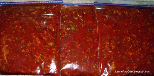
Baggies of sauceAs I write, Odel is cooking his special pasta sauce, filling Scoopy with the most enticing smell!  He agreed to share his recipe with you, so I’ve added it to the recipe archive. 

This is the best red pasta sauce I’ve every tasted.  When I first met Odel, he made it with beef and mushrooms.  Since I don’t like mushrooms, he switched to olives (much better), then experimented with Italian sausage instead of beef (even BETTER).  This is the perfected recipe that he has made for the last several years.  We like it best on short, sturdy pasta (shells, tubes or bowties) that can easily be forked up with sausage and olives.  The recipe makes eight servings; we eat two servings the day he makes the sauce, then divide the rest into 3 zip lock baggies and pop them in the freezer for an easy dinner later.  Enjoy!

Thursday, October 28, 2010

YOSEMITE WAS A WASHOUT - YOSEMITE NATIONAL PARK, CA

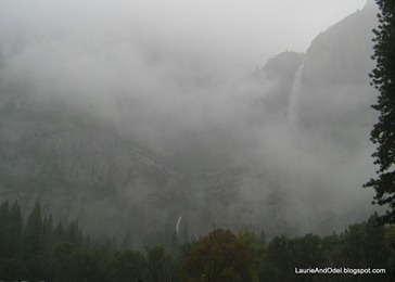
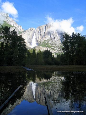
What we expected to see.

What we saw.

What we expected to see in YosemiteWhat we saw

More than a year ago, a chance encounter with a sociable couple at a crossroads on a hiking trail in northern California led me to formulate a plan: a full moon hike along the Glacier Point road in Yosemite National Park at 8.000 ft. elevation. Our target: Sentinel Dome. Our plan: Hike to the dome (just 2.2 miles round trip) late in the day, taking along a picnic dinner. Watch the sunset as we enjoyed our picnic, then lounge around on top of the dome while the full moon rose. Hike the short distance back to the car in the moonlight. Woohoo… fun!

Yellowstone washoutThe hilly, winding drive into Yosemite is not for Scoopy, so Part Two of the plan involved reserving accommodations in the park – we didn’t fancy a long, post-hike drive. My mom and dad hadn’t been to Yosemite for quite awhile, so we rented a cabin, big enough for four people, at Yosemite West, an enclave of private homes just outside the park boundary, accessible only from the park. We liked the idea of having a kitchen and plenty of room to spread out. A big bonus: the access road to the rental cabin was only 1/4 mile from Glacier Point road in Yosemite.

The final piece of the plan was to determine the dates of the full moon in October, a perfect month for this sort of adventure: the weather is likely to be mild and dry, snow would not yet have closed Glacier Point Road, and the summer crowds would be long gone. The dates in 2010: October 23rd and 24th – a weekend! As retired folk, it would have made more sense to visit during the week, but Mother Nature has her own schedule and, since the full moon was key our planning, we reserved our cabin for the weekend.

Thus, early last August, our reservations were made and our plan complete.

Reflection of Yosemite FallsThe weeks leading up to October 23 and 24 were sunny and mild. Monday, October 25 (the day we returned home), was lovely, crisp and clear. The weekend? A complete and total washout, with some of the heaviest rain Yosemite has experienced all year! Peeking out our window at the pouring rain (and heavy wind) on Sunday night – our date with Sentinel Dome – we caught not even a HINT of the huge October full moon… up there somewhere, hidden behind the think and sodden clouds.

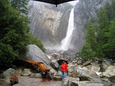
After spending Saturday afternoon and evening indoors – while light rain fell outdoors – Odel and I dressed for wet conditions on Sunday, grabbed umbrellas, and headed back to the valley for a long walk in the rain. By this time, after twelve hours of rain, Upper and Lower Yosemite Falls had picked up considerable water, and the Merced River was nudging well up into the grassy meadow along its banks.

We got home just as the real downpour started, pretty well soaked. That night, the night of the planned hike? It POURED! Even the luxurious cabin we rented sprang a leak!

Monday was our day of departure, and we awoke to calm and quiet. The remaining clouds cleared as the sun rose, and we headed back down through Yosemite Valley in bright sunshine.

Thanks to the heavy rains, Yosemite’s famous waterfalls were booming, sending up huge clouds of spray. The Merced River was a tumultuous tumble of whitewater, overflowing its banks onto the meadow boardwalk Odel and I had hiked 24 hours earlier. It was MAGNIFICENT, awe-inspiring!

After an overpriced lunch at the beautiful, historic Ahwahnee Lodge and one last walk in the welcome sunshine, we reluctantly left the valley and headed back to Sacramento. While our plan was a bust, we had a good time - lots of weekend football, a challenging jigsaw puzzle, and more than enough delicious food. As for the full moon – there’s always next year!

Cloud on El CapitanOdel, Bev (Mommy), Bill (Daddy) - three happy campers.
Damp face of El Capitan steams in the sunshine.

Odel, Bev (Mommy), Bill (Daddy).

Tuesday, October 19, 2010

THANK YOU, AUTO DOCS COMPLETE CAR CARE – FERNLEY, NV

Across from the Bob Scott Campground on Hwy 50 near Austin, NV Our last overnight stop along “The Loneliest Highway in America” was a gravel pullout alongside the road near the top of Austin Summit, across from the Bob Scott Campground, a few miles east of Austin, Nevada.  We’ve stayed in this pullout before, and choose it over the little USFS campground for a few simple reasons: it’s free, we can run the generator whenever we want without bothering anyone else, and we don’t need to unhook the Jeep.

I won’t be reviewing this overnight spot on my campground review blog, We Called It Home, but will mention the other important attributes: strong Verizon cell service for phone and aircard, very dark at night, no obstacles for the TV satellite dish.  It is a bit noisy until after around 10 pm, when most traffic along Hwy 50 seems to stop.  

As we prepared to leave in the morning, we found that our Brake Buddy - the auxiliary braking system we use to apply the Jeep’s brakes when we slow/stop the motorhome – was not working.  It plugs into a 12 v. power supply socket in the Jeep, and we discovered that the fuse to the power supply socket was blown… so it turned out that the Brake Buddy was fine, but wasn’t getting power.  Each time we replaced the fuse to the power supply, it blew immediately.  Uh, oh – except for thinking “we must have a short” and “bummer”, we had reached the end of our fix-it-yourself routine. 

Looking down on Austin, NV, heading west on Hwy 50. The drive down the west side of Austin Summit into the little town of Austin, NV, is a doozey – long, steep, and very curvy -  and we had a couple more passes to climb and descend before we reached Fernley, NV, our planned stop for the night.  Since traffic along our route was almost non-existent, we decided to continue to Fernley with the Jeep in tow, but we needed a fix before we heading west on I-80 into California on Wednesday. 

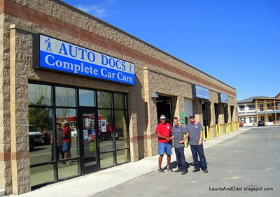
First thing Monday morning, Odel began calling Fernley’s auto repair shops.  The first one was busy until Thursday (we’ll be long gone by then), so referred us to a second shop.  He couldn’t fit us in until Wednesday (too late), so referred us to a third shop, Auto Docs Complete Car Care.  Odel went off with the Jeep.  I stayed home, hoping they could find the source of the problem and repair it by the end of the day.

An hour later, Odel was home with a big grin on his face.  Fixed!  When I asked what it cost, he told me it was free!  Huh?  When Odel took the car in, Tom, the owner, said they would take a look at it right away to diagnose the problem.  Odel took off for a 45 minute walk.  When he returned, the short had been isolated and the simple fix made – simple, but it required removing several of the dashboard panels, which were being reinstalled by Ryan when Odel returned.  Odel’s quick mental calculation:  parts cost – minimal; labor cost – around an hour, $50 to $80 bucks, maybe?  And, “great, it’s fixed!”

Odel, Ryan and Jason outside Auto Docs When Odel asked for the bill, Tom (the owner) said “I try to do a good deed every day, and today, you are that good deed.”  Odel was floored, knowing Ryan had spent close to an hour on the repair, but Tom steadfastly refused any payment.

After Odel told me that story, I said “Let’s go, I want a photo!”.  When we drove back, Tom had gone off on a errand, but Ryan and Jason were happy to pose with Odel.  Tom, if you ever see this, THANK YOU!   Your generous and unexpected gesture of goodwill made our day!

To our traveling friends, if you need automotive work done in Fernley, Nevada, visit Auto Docs Complete Car Care, 405 S Center St, Fernley, NV 89408-4708; Phone number: (775) 835-8981.

Sunday, October 17, 2010

SHAKEN BY NEWS FROM YESTERDAY

Heading West on 50 Because of connections we have made through this blog, our world of “virtual friends” in the RV blogging community is large.  Yesterday we received shocking news from our blogging family – Margie and Bruce Mallin (known through her comments as Margie M.) were struck and killed as they walked together near their RV park in Pismo Beach, California.  The driver of the car that hit them is a 19 year old who is alleged to have purposely left the highway at high speed, intending to kill himself.  Instead, he killed Margie and Bruce, injured himself, and is now in jail.

Reading of this accident was incredibly shocking, and it remains foremost in my mind today as I sit to write my own blog.  We had never met Margie and Bruce, but I read her blog frequently and enjoyed the comments she occasionally left on mine.  Their daughter, Stephanie, notified her parent’s RV’ing friends by posting the news on Margie’s blog, and the outpouring of shock and sadness was immediate.  Many of those who left comments shared anecdotes of Margie’s kindness and encouraging words.  Margie and Bruce will be sorely missed, and my heart goes out to Stephanie and her family.

As I made our dinner last night, as we sat together and ate, as we discussed our travel plans for today, I kept thinking “this is what Margie and Bruce did on Friday”.  Normal, mundane activities.  In their minds’ eyes they would have been picturing their day Saturday, beginning with an early morning walk and including… what?  A visit to the beach?  Time spent at the Pismo Beach Clam Festival? 

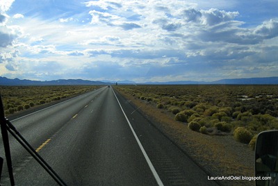
"The Loneliest Roadin America" Odel and I are always full of plans, plans for the rest of the day, for tomorrow, next week, next winter and next year.  I’m sure Margie and Bruce were, too.  In a heartbeat, that future ended and their family’s lives turned upside down.  So quick.  So final.  So hard to believe and so shocking.

Bruce and Margie were living a life they loved, and from their blog, it seems as though their relationships with friends and family were strong and positive with no unfinished business.  We, too, are lucky to be living a life we wouldn’t change, and I hope everyone in our circle of family and friends knows they are loved and valued by us. 

So, as we roll on across Nevada heading west, we’re shaken by the news of this loss, far less focused on small hassles and more focused on gratitude for our friends, families, health and freedom.  Margie and Bruce will be much missed by their RV’ing family, and today’s blog couldn’t be “business as usual”. 

Safe travels, friends.  As our friend Bobbie Chapman always says, “Remember, you are loved”.

Saturday, October 16, 2010

HEADING WEST: MOAB TO EASTERN NEVADA

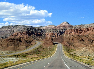
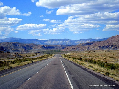
Gorgeous vista on I-70 heading west. A week from today, we’ll be on vacation!  Seems like our life is a vacation, doesn’t it?  But, yes, we are taking an out-of-the-RV vacation in Yosemite National Park next weekend.  Consequently, we have a time commitment, so are on a tear to cross Utah and Nevada within a few days time.

Our plan is to take Interstate 70 to Interstate 15, transition to US Highway 50, and follow it west to Reno, then take I-80 into the Sacramento area.  We don’t plan to do much sightseeing, so we can easily travel the distance in 4 days.  We’ve given ourselves a three day window of time to cross Donner Pass through the Sierra in case the weather doesn’t cooperate (we don’t want to end up like the Donner party!).

Besides rolling away the miles, we hope to do our usual hike/walk each day, and it was very easy to do so on Friday.  We pulled out of our campsite at OK RV Park a little after 9 am, drove 10 miles to a convenient pullout, and walked several miles along the wonderful paved bike trail that runs along Hwy 191 from Moab to Arches National Park and beyond.  By 11 am, we were pulling out once again, heading north to I-70. 

I-70 Utah PanoramaAs we passed the entrance to Arches National Park, we both did a double-take: the lineup waiting to pass through the entrance booths was probably 40+ vehicles long!  It had been obvious to us that Moab was filled to capacity, but… WOW!  I’m glad we weren’t in that long line.  Those trails are gonna be crowded.

Thus began a 336 mile day, very unusual for us.  After a couple of hours of scenic I-70, we pulled over at a view point, ate lunch, stretched our legs, and set off once again.  We had pinpointed several boondocking spots along Hwy 50 (“The Loneliest Road in America”) short of the Nevada border that would work for an overnight campsite, so figured we’d find an appealing one and stop around 6 pm, as twilight approached.

Of course, the farther west we traveled, the longer it stayed light… and the last 50 miles of Utah before we crossed into Nevada near Great Basin National Park were some of least attractive, most desolate miles we traveled all day.  Since we have visited Great Basin N.P. a few times before, we knew there was an appealing rest area just a few miles past the turnoff to the national park that would make an excellent overnight spot.  We decided to push on another 50 or so miles. 

View at our lunch stop We gained an hour as soon as we crossed the state line into Nevada, and pulled into pretty Sacramento Pass Recreation Area Scenic Pullout (click here to read our review and see photos) at 5:30 pm, just as the sun dropped behind a mountain top.  That’s a mighty long day of driving for us, and it is so unusual for us to be on the road that late in the day (our typical travel hours are 10 am to 2 or maybe 3 pm); heading into the setting sun, we actually lowered our automatic sun visors.  It worked out well, though, and shaved a few miles of Saturday’s drive.  California, here we come!

Wednesday, October 13, 2010

WRAPPING UP OUR STAY IN MOAB, UTAH

Wow, our stay in Moab went by quickly!  Tomorrow we are taking Scoopy to a tire shop to have a sloooooowwww leak repaired.  Once we return to our site at OK RV Park (click here to read our review) and settle in again, we’ll head out for one last hike, followed by dinner out.  On Friday, we’re off, heading west.

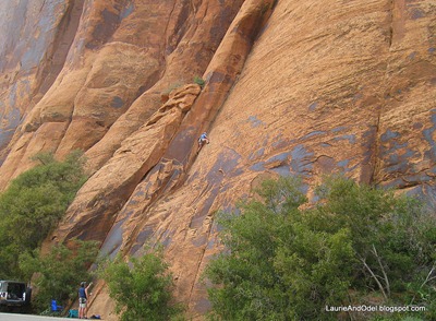
Climbing on Wall Street (Potash Road)Though the town of Moab itself doesn’t knock my socks off, I would be happy to spend a month here (in the right time of year) – there is that much to do.  We’ve hiked every day – except for the two when Odel played golf – enjoying the amazing variety of rock formations in all directions from Moab.  We’ve seen people doing all sorts of adventurous activities, in places we would never go! 

The day we hiked to Corona Arch, we stopped along the Colorado River on our way home, in an area called “Wall Street”.   Half a dozen groups of climbers were engaged in their sport along this stretch of rock cliffs, and we spent at least half an hour watching this woman (photo, above – click to enlarge) climb the rock face.  We were close enough to hear her labored breathing as she slowly inched her way up the rock – it looked and sounded exhausting. 

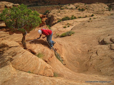
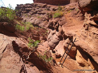
More than one reader asked about the photo of the ladder I posted on my last blog – me climbing a ladder on our hike to Corona Arch.  Usually, camera shots show trails as less steep than they actually are, but in the case of that photo, the terrain looked far steeper than it really is.  The ladder is only about 6 or 7 feet long, just enough to climb from one reasonably flat rock slab to another.  Looked wild though, didn’t it?  :) 

Odel heads down the ladder on the Corona Arch HikeHere’s a photo of Odel on that same ladder in a shot that gives a more accurate perspective.  Still, for us, anything involving safety cables and ladders stretches our flexibility a bit more than usual!  My knees were talkin’ to me, and they didn’t sound happy.

Since we have visited Arches National Park in the past, I intentionally left my camera at home the day we hiked to Delicate Arch (the iconic image that often represents both the park and the state of Utah).  We also drove the short distance to North and South Windows, past Balanced Rock.  (You don’t need to be a hiker to enjoy Arches N.P. – most of the famous formations can be seen alongside the road, from view points, or at the end of a very short walk.)

If I’d had my camera, I would have taken another several dozen photos, different views (or, more likely, the exact same view!) of the timeless arches and vistas I have already photographed.  So, no photos today from the park, but I do have a couple to share from our hike yesterday, along SR-128 at Fisher Towers, 22 miles from Moab.

“The Titan” at Fisher Towers.  We hiked around the right side, along the base of the formation. Another ladder!  I wish they would offer a few more handholds at the top – it’s a scramble.
The Titan at Fisher Towers Another ladder

Once again, we saw rock climbers apparently having a ball climbing some of these fantastic formations.  We stuck to the trail, with its little ladder, and felt we’d done pretty well.

The list of what we didn’t see is longer than the list of what we did… another place we will need to revisit.  Darn!  :)

Monday, October 11, 2010

SOUTHEASTERN UTAH’S RECREATION MECCA: MOAB AND ARCHES NATIONAL PARK

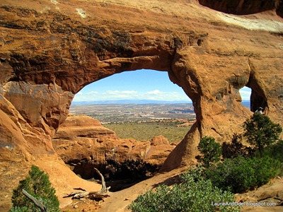
Beautiful Partition Arch, high above a panorama of Arches National Park After our nine day stay in little Torrey, Utah (population 171, with that many again in the surrounding area), Moab (population 5,100) seems like a bustling metropolis!  Every morning, at appears that the residents fling open their doors, jump on their bikes or into their muddy, tricked-out 4 x 4’s and take off into the great outdoors.  Hikers, mountain bikers, walkers and joggers jostle for space with road bikes, monster trucks, jeeps and motorcycles. 

Of course, the ranks of the full-time residents are augmented by active visitors.  Campgrounds, RV parks and motels are full, with their occupants adding to the crazy activity level we see every day.

This is our third trip to Moab and Arches National Park, and the first time the weather has cooperated perfectly, with highs around 70 degrees and unlimited sunshine.  We’ve hiked in the national park three times, and outside the park once.  The big difference?  The other people on the trail in Arches National Park speak a multitude of languages, including several we couldn’t place, LOTS of foreign visitors; on the Corona Arch hike outside the park, we joined local families on what obviously is a favorite “local” hike.

Odel on Park Avenue


The day we arrived in Moab, we settled in our campground then headed up to Arches National Park to hike the short Park Avenue trail.  Here’s Odel heading down the wash.
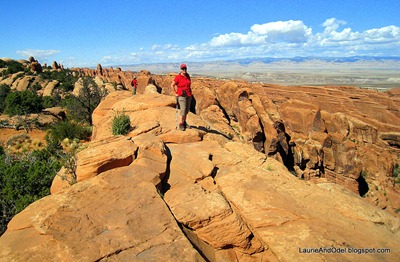
LB on the fin
One of the longer hikes in Arches is at the very end of the park road at Devil’s Garden.  Part of the Double O trail past Landscape Arch traverses the top of a “fin”, not for those who don’t like heights!
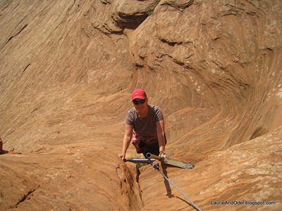
LB coming up the ladder
The fun hike to giant Corona Arch, off Potash Road – outside the park – includes a couple of safety-cabled stretches and a short ladder up a steeper pitch.  Here I am, climbing the ladder.  We saw a lot of families with kids and dogs enjoying this trail.
OK holds the arch

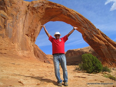
Photographing Odel in the foreground of Corona arch makes it look smaller than it actually is.  You can find a video on YouTube of a single engine plane flying through this arch!

No hiking for us today: Odel is on the golf course and I’m about to head out to explore “downtown”.  More to come but, for now, the sunny blue skies are calling me.  :)

Saturday, October 9, 2010

TORREY, UT, AND CAPITOL REEF NATIONAL PARK: WE’LL BE BACK!

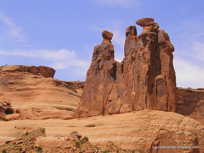
The Three Gossips, Arches National Park So that we could have breakfast with my sister Sydney in Moab on Friday morning, we left Torrey on Thursday for the easy drive to Moab and Arches National Park.  It is our third visit to Moab and Arches, and the first where the daytime temperatures are forecast to be well under 100 degrees.  YAY!

While Capitol Reef is fresh on my mind, I decided to make some notes for our next visit.  You might find my thoughts/opinions helpful it you decide head to this lesser-visited national park.  Except for the top photo, all photos are from the Capitol Reef area.

Recommended Drives:

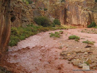
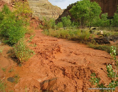
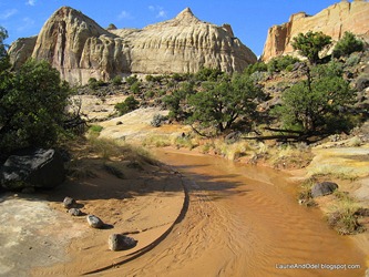
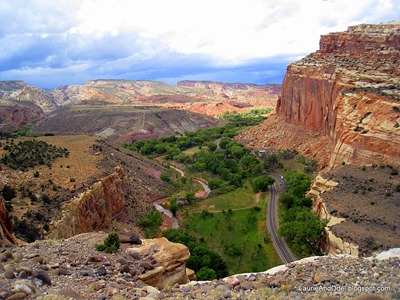
Besides Highway 24, which passes through Capitol Reef National Park, the only other paved road in the park is the Scenic Drive, which heads south from Hwy 24 past the park’s grassy Fruita campground.  It ends in a couple of miles of dirt/gravel road.  A fun drive, it shows off much of the park’s geology and scenery.  It was closed during heavy rainfall when the washes filled with tumultuous red waters.

Aspen on Boulder Mountain Highway 12: Torrey to Boulder to Escalante.  From Torrey south to Boulder, Hwy 12 traverses Boulder Mountain, beautiful in fall when the aspen are golden.  This portion of the road summits at 9,600 ft. elevation.  From Boulder to Escalante travels through beautiful rock formations of the Grand Staircase-Escalante National Monument.  We might have seen Boulder Mountain at its most beautiful – fall colors – but the panoramic views would be spectacular on any clear day.
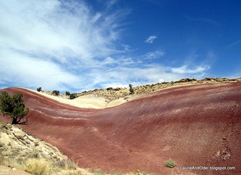
Burr Trail from Boulder to Notom-Bullfrog Road: Paved traveling east to Capitol Reef boundary, then unpaved.  Highlights are Long Canyon (paved) and the southern section of Capitol Reef National Park, including the incredible Burr Trail switchbacks.  Travel this road east to west if you prefer to climb the switchbacks, rather than descend.  Scenic picnic area at the top of the switchbacks.  I’d like to hike the Muley Twist Trail (in Capitol Reef NP) on a return trip.

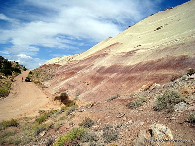
Odel and Jules on Notom-Bullfrog road Notom-Bullfrog Road between Hwy 24 and Burr Trail.  Great rock formations and colors; spectacular vistas.
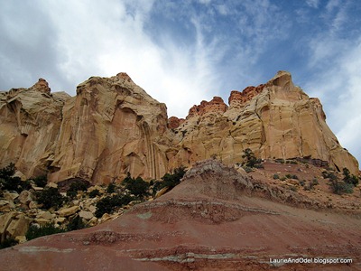
Fish Lake Basin: if you are in the area when the aspen have changed color, this is a spectacular drive with the opportunity for an easy hike along the lakeshore – but my first choice would be Boulder Mountain (Highway 12 from Torrey to Boulder), which also highlights the fall colors.

Next time, weather and road conditions permitting, I’d drive the Notom-Bullfrog Road all the way to Bullfrog Marina. 

The “primitive” Cathedral Valley road loops through the northeast corner of Capitol Reef National Park; if Odel wasn’t interested in driving the long (57 miles) dirt road, I would consider joining a tour (there were at least a couple tour companies in Torrey).

Recommended Hikes (all from the Capitol Reef Trails map available at the visitor center):

Cohab Trail from Fruita Campground (Capitol Reef National Park) to the Fruita Overlook: moderately strenuous, we found it to be a workout but not exhausting.  About 2 1/2 miles total, out and back.  Great views and fun traveling through the rock formations. 

Big rocks of Capitol ReefThis hike is mostly on rock, though 1/4 mile traverses a wash high up through a canyon.  The Cohab trail links with others (including the spur to the overlook), so you can extend your hike if you want – or walk the length of the trail to its end at Hwy 24 (across from the Hickman Natural Bridge parking area), then either shuttle or hike back.

Grand Wash Trail: very easy walk through a wash, including “the Narrows”, a canyon with 1,000 ft. high rock walls (not a slot canyon). 

Hickman Natural Bridge: The map rates this as “moderate”, no doubt due to the uphill section at the beginning of this 1 mile (one way) hike.  Be sure to take water.  At the BIG natural bridge, the trail loops to the left (under the bridge) for great panoramic vistas off to the southwest.

Rim Overlook Trail: This trail branches off of the Hickman Bridge trail for another two miles.  The map rates it as “strenuous”, due to the steady uphill climb.  We didn’t have time to follow it to the end, but will do that on a future visit.

East side of Capitol ReefI’d like to hike the Cassidy Arch trail (it begins in Grand Wash), but the rain washed out our hike that day. 

Campgrounds:

We stayed at Wonderland RV Campground, at the junction of Hwy 12 and Hwy 24.  Click here to read our review.  Make a reservation if you plan to stay there.  The national park campground (Fruita, no hookups) was full every day before noon during our nine day visit.  We drove through Thousand Lakes RV Park, at the western edge of Torrey, which looked very appealing  (their sites also slope slightly) – might give them a try on our next visit.

Dining Out:

We ate at two restaurants in town, Cafe Diablo and Capitol Reef Inn and Cafe.  My thoughts?  Torrey is rather remote, and is very small.  There is no supermarket in town; the nearest reasonably sized grocery store is 20 miles away.  Perhaps for these reasons, restaurant food seemed overpriced for the quality, and when supplies run out, menu items are unavailable – we heard “oh, so sorry, we are out of that today” more than once. 

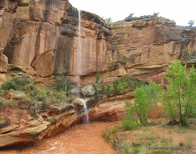
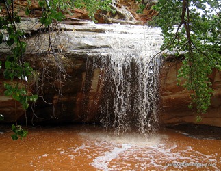
Temporary waterfall after the big rains.Though we had attentive service at Cafe Diablo (where our entrees were nothin’ special, given the price), the service at Capitol Reef Inn and Cafe was abysmal (though the food was above average) – just the opposite of our friend Sue’s experiences (read her review of both restaurants here).

I doubt that we would plan to eat out (except with friends) on a return trip, but if we do, we’ll try Rim Rock Restaurant, on Hwy 24 heading toward Capitol Reef.  Kate and Terry, our neighbors at Wonderland RV Campground, ate there and enjoyed it and, at the very least, it has a spectacular view!

If you don’t want to eat out, plan to stock up on groceries BEFORE you come to Torrey.  The nearest supermarkets are probably in towns on I-70, and there is a small independent grocery store in Loa, 20 miles +/- to the west.

Thursday, October 7, 2010

DRY TO WET: THE CHANGING FACE OF CAPITOL REEF NATIONAL PARK

After two days of almost non-stop and frequently heavy rain – including thunderstorms – the National Weather Service issued a Flash Flood Warning, a Flood Warning, and a Tornado Watch.  We sat inside and watched the sometimes-exciting but mostly dreary weather roll over us.

Cabin fever hit me hard on Wednesday afternoon, and I asked Odel if he wanted to come along on a driving tour of Capitol Reef National Park.  It seemed likely that the Scenic Drive south through the park was closed (it crosses several washes, including Grand Wash, where we hiked on our first day in the park), but I wanted to see the effect of 48 hours of rain on the Fremont River.

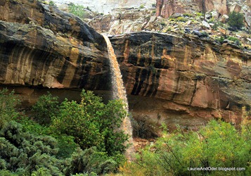
As we headed east into the park, the rain turned to a sprinkle, and stopped by the time we passed the visitor center.  Along Highway 24, we were surprised to see waterfalls pouring off the sides of the cliffs.  WOW!   The waterfall on the left is a pour-off from the high wash through Cohab Canyon, where we hiked through dry sand just a days ago.

A long drop Short drop, big pool

Along side the highway, we could see the Fremont River churning it way to the east.  We continued to the Grand Wash turnoff, to see how the trail looked.  Scary, that’s how!

Grand Wash, western end, September 29

Grand Wash, eastern end, October 6

Grand Wash Trail, western trailhead Grand Wash, eastern trailhead

The sign in the “dry” photo says: “Grand Wash.  Do not enter if storm threatening.”  10-4 that!

After watching the water race through the wash, we headed back to the parking lot for the Hickman Natural Bridge trail.  We had hiked there earlier in the week (I had left my camera battery in the charger, so no photos that day!) and knew the parking lot afforded a good view of the Fremont River. 

Again, WOW!  Unlike the placid waters we had admired in days past, the Fremont was a churning mass of red mud, inundating its low banks, carrying away mud and grasses.

Churning Fremont RiverAs I took photos, Odel socialized with a couple near the trailhead, discovering that the Scenic Drive was indeed closed, just past the campground.  I can only imagine the mud and water flowing across the road.

As we chatted with the other bystanders watching the river, the sky lightened and the clouds began to break apart, finally!  We grabbed our water bottles and rain jackets out of the Jeep and took off up the Hickman Natural Bridge trail. 

It felt SO good to stretch our legs and lungs!  Instead of heading to the impressive natural bridge, we turned right at the trail junction on the Rim Overlook trail.  Only one set of footprints marked the wet sand of the trail ahead of us.  Twice we forded a small creek that was not there a few days ago, and eventually found ourselves high on the canyon rim, looking down once again onto Fruita, the campground, and the visitor center – even down on to the high view point we had enjoyed a few days earlier on the other side of the canyon.

No hikers followed us up the rim trail.  The quiet, the views, the scent of dry rock and soil now awash with water, the perfume from the bruised leaves of desert brush and juniper trees… the burbling song of small, short-lived creeks dropping into pools, the drip of water off a rock… the welcome warmth of sunshine on our faces and arms.  Oh, how we savored it all!

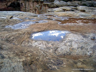
On the Rim Overlook Trail - a "new" creek Short-lived puddles reflecting the early evening sky.

We started too late in the afternoon to stay on the trail as long as we would have liked, so reluctantly retraced our steps as clouds hid the sun once again.  Without rain feeding it for the past couple of hours, the creek we forded heading out was already smaller heading back – but as we neared the edge of the canyon, we could hear the roar of the still very mighty Fremont River.  We climbed back into the Jeep, shoes and pant legs painted with red clay mud.

That was our last hike in Capitol Reef National Park for this year.  Today we head off to Moab to hike the trails of Arches National Park.  I’m SO GLAD we stopped here in Torrey… and I know we’ll be back!

Tuesday, October 5, 2010

A DAY OF RAIN, A RECIPE, AND HIKING THE COHAB CANYON TRAIL IN CAPITOL REEF N.P.

We fell asleep to the soft pitter-patter of raindrops last night, and awoke to low clouds and wet roads.  Today’s weather included drizzle, heavy rain, flash flood warnings, lightening and thunder – and a couple periods when the rain stopped, but never long enough for a hike.  :(

Since we were indoors so much of the day, I found time to type up the recipe for German Potato Salad cooked in the crockpot, and I’ve added it to the “Recommended Recipes” archive on the left side of the blog (scroll down).  Let me know if the link is not working; it looks like Google has changed a few things since the last time I created and published a document.

Yesterday’s weather was a mix of sun and storm, and we managed most of a fun hike before the storm broke.  Here is the photographic story of the Cohab Canyon Trail.  It starts in Capitol Reef National Park just across from the Fruita Campground.

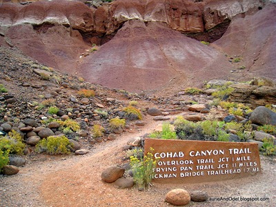
Beginning of the Cohab Canyon Hike
From the trailhead opposite the campground, you hike up a steep hillside to a cleft in the high rock wall, into a high canyon, then either north to the overlook, south to the Frying Pan trail, or continue on until the trail ends on Highway 24.  We hiked to the Overlook and back.
Starting up the switchbacks.

We gained altitude quickly as the tight switchbacks climbed the slope below the high rock cliff.  The canyon walls across from us in this photo look much like the slope we were hiking.
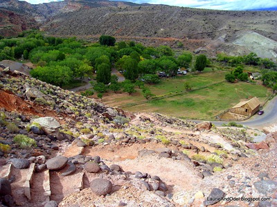
Looking down on the Cohab Canyon trail switchbacks.  


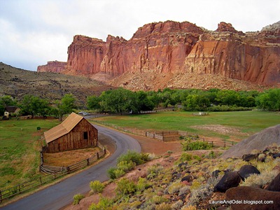
This view shows Fruita campground (in the trees) from near the top of the switchbacks.  The old barn is now far below.


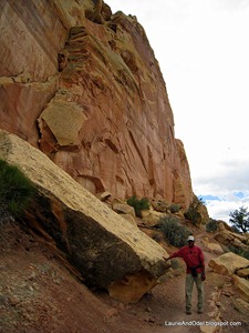
Odel is standing at the bottom of the face of the rock cliff.  Our trail skirted the bottom of the cliff, high up on the canyon wall.  Rock wall on one side, steep drop off on the other… and it looked as though the cliff face could not be penetrated. 

Then, suddenly, an opening in the cliff face, and we made a 90 degree turn into a high canyon.
Odel on the narrow cliff trail.


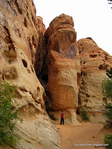
I posed, hands above my head, to provide scale for the canyon walls.  We were several hundred feet above the campground, and safely away from the cliff-edge trail.
Laurie posing in the upper canyon.
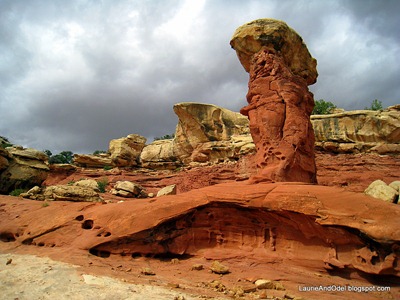
Intriguing shapes!


Our high canyon opened up after about a 1/4 mile.  The rock formations were fantastical, the colors striking and varied.  Dark clouds were sweeping across the sky, moving fast.
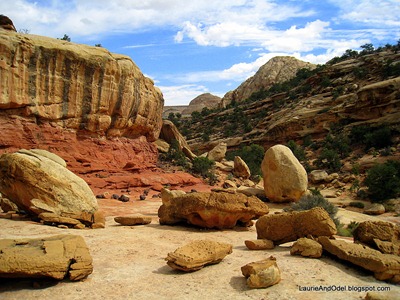
Scattered boulders


Our trail wound its way around boulders and rocks of all sizes and shapes scattered across the slick rock floor of the high canyon .
Looking down on Highway 24 and the Fremont River

We found our trail junction, turned north, and hiked another 1/4 mile or so to the canyon overlook.  Here, we must have been a thousand feet above the floor of Capitol Reef National Park. 
The domes of Capitol Reef National Park, on the other side of Highway 24.

After I took this photo from the overlook, looking directly across Highway 24 to the domes,  lightening struck to the west and the clouds thickened.  The wind picked up, so we hurried back, arriving at the opening in the cliff face just as the storm struck.

With our raincoats on, we huddled in the shelter of a huge boulder until the first wave of rain passed, then made a hasty descent to the valley floor.  Whew!

Monday, October 4, 2010

THE BURR TRAIL AND NOTOM-BULLFROG ROAD: AWE-INSPIRING!

Between Torrey and Escalante on Highway 12, the historic Burr Trail (click here to read the history of the trail) heads east from the little town of Boulder.  The road is paved for the first 31 miles, until it reaches the boundary of Capitol Reef National Park.  From there, you are less than a dozen miles, on a graded dirt/gravel road, from one of the highlights of the drive: the Burr Trail switchbacks.
Burr trail switchbacks from the top.We set out at 10 am, driving south through – once again – the blazing aspen on Boulder mountain.  Today, no tree photos!  Many more cars and RV’s traveled Hwy 12 on Sunday than we had seen during the week, many of the vehicles towing ATV’s on trailers.

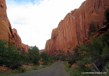
In Boulder, we turned left, heading east, winding down the narrow curves of the road to The Gorge, then rolling into Long Canyon, seven miles of deep red, vertical rock pressing in on both sides.  Our sunroof was vital to the sightseeing here!

Long Canyon on Burr Trail Looking out the top in Long Canyon

The road was narrow, the walls were high.

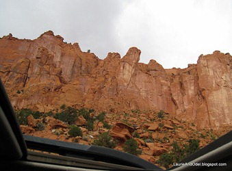
Sightseeing was easier with the sunroof open!

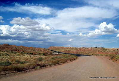
Once we were through Long Canyon, the vista opened up.  We stopped at a pullout just before we descended into a wide, level valley.  The colors and shapes were eye-popping!

At the east end of Long Canyon Along the Burr Trail in Capitol Reef

A colorful gorge from the viewpoint.

Just past the western boundary of the park.

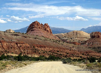
Once we descended into the valley, the spectacular rock formations were a very distant views.  Lots of small bushes, a few bumpy dirt roads heading off here and there.  As we approached the Waterpocket Fold, a 100-mile long bend in the earth’s crust that is the centerpiece of Capitol Reef National Park (and so named by John Wesley Powell for the basins or "pockets" which collect and hold drainage water), the scenery began to improve once again… and the pavement ended.

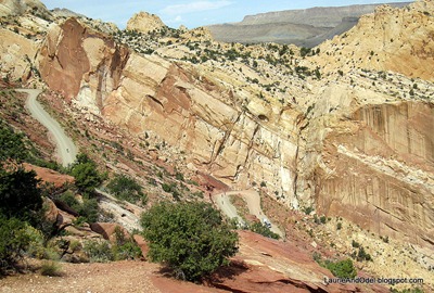
Bikers and two switchbacksDuring our drive along Burr Trail, we saw fewer than half a dozen vehicles.  Imagine our surprise when we arrived at the picnic area at the top of the Burr Trail switchbacks and found a gaggle of lycra-clad bicyclists, along with their sag wagon and trailer! 

They and their bikes were spread over a red rock viewpoint, where they could examine the challenging switchback descent as they enjoyed their lunch.  I took the very top photo from the same viewpoint – look closely at it and you can see two of the switchbacks stair-stepping down to the road through the canyon.

We carried our lunch to the single picnic table in the signed picnic area, keeping an eye on the bikers so we could watch their descent.  We heard the squeal of their brakes all the way up at the top of the canyon!  See the ant-sized bikers in the photo above, left (click to enlarge)?

Looking back to switchbacksNext it was our turn.  We put the Jeep in first gear and rolled slowly downhill, negotiating the twists and turns of the road while we (well, I – Odel kept his eyes on the road!)enjoyed the incredible view. 

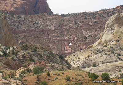
At the bottom, I turned around and photographed the descent – unfortunately, poorly lit.  In this picture, a tiny car provides a bit of scale – click to enlarge the photo, then look just above the white triangle.

With that descent behind us, we were on the valley floor, the Waterpocket Fold to our west, gloriously colored rock formations – of the most incredible variety - to our east.  I thought this would be one of the least appealing parts of the drive – lower, hotter, and less spectacular – but I was so wrong!

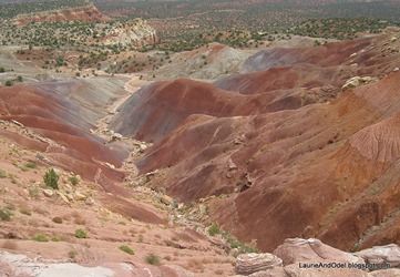
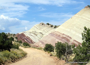
Purple and white hills Purple Hills, blue sky


We drove a couple of miles though rounded hills of purple and cream, then the vista opened again – sweeping ramparts and billowing clouds to the east, the Waterpocket Fold of Capitol Reef National Park to the west.
Ramparts and clouds


Finally, we found pavement!  Fortunately, the surface of the dirt road was mostly decent, apparently graded within the last couple of months.
Back to pavement

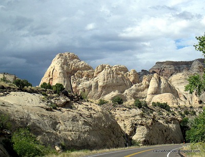
We hit Highway 24 in another 10 miles (more or less), and turned west to drive through Capitol Reef National Park back to Torrey.  I took this photo in the area of the cream-colored, “capitol building” domes that give Capitol Reef its name.

The scenery never stops in this part of Utah!
Capitol Reef Domes